


Μετάφραση ![]()
Kastelli - Dokos Castle - Τop - Kastelli
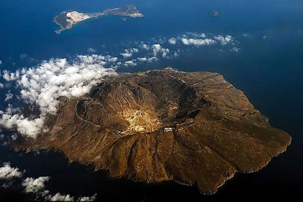
The islet of Dokos is 7 nautical miles from the port of Hydra to the small dock below Kastelli and the communication is done only by sea taxi.
The island is deserted and there are only a few scattered residences, of which few are inhabited and one of them is in Kastelli where the hiking route.
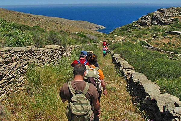
The hiking route is in the eastern part of the island, where there is a small pier in the gulf of Skindos, which is taken by sea taxis. Above the jetty there are some farmhouses where the last inhabitants of the island live. From the collision, one goes north to the castle that surrounds the steep peak at an altitude of 132 m. This castle dates back to the Byzantine period and its purpose was to control the sea passage along the mainland coast.
The island of Dokos is also known for finding an ancient wreck at the end of the 3rd millennium BC. (2.200 BC) with thousands of remarkable ceramics and stone finds at Myti Kommeni north of the castle, which have been transferred to the archaeological museum of Spetses today. The findings of the Dokos shipwreck that provided important information to archaeologists for the Early Helladic era.
Dokos was the source of the gray stone that served to build the mansions of Hydra and the rare red stone used to pave the houses.
Returning from the castle on the gorge, a distinctive path leads to the highest point of the island, the peak at an altitude of 288 m. On the way the hiker enjoys the steep slopes of Dokos, while near the sea can be seen the stone-built lighthouse, which together with Zourvas and Spetses regulate navigation in the area. An interesting route to an unchanging landscape as there are no roads and cars on the island. Access to the island is a bit difficult as it is done by a sea taxi that has to take you and return to get you.
The route is not very easy and needs a little experience in mountain hiking. From the top it is possible to head one at the other end of the bay of Skiton but the route is difficult because of the vegetation from dense bush. There is no marking.
Ground condition: Trail 3,5 km (100%), dirt road 0, asphalt 0.