South Aegean
Cyclades
Thira
Karterados
Altitude: 137 m
Population: 1.238
Postal Code: 84700
Telephone code: 22860
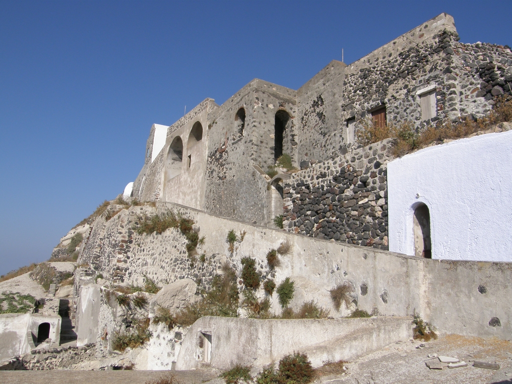
Karterados village lies almost at the center of Santorini, approximately 1.5 km southeast of Fira. It is a scenic village built in a ravine, overlooking a long green valley with vineyards and the east shores of the island. It's architecrure is quite interesting, as there are many cave houses built into the rock face. Wandering along the quaint, paved paths you will see many of these houses built in the gorge. Many of them were destroyed by the 1956 earthquake, only to be restored later. The name of the village comes from the Greek word 'karteri' meaning ambush point, probably because ambushes were set up there to trap pirates.
Its existence dates back to the 17th century but the village flourished during the 19th century when it became a rich and prosperous village with many local shipowners building their elegant mansions there. Remarkable whitewashed churches and chapels such as the Church of Ascension and Agios Nikolaos stand out for their brilliant architecture. In the central square there is a beautiful windmill and a memorial plaque for the fallen in World War II. Karterados offers a great variety of restaurants, cafes, villas, hotels and apartments.
Check if the village is officially recognized for its cultural or historical significance. This includes monuments, protected settlements, and historical settlements according to the Ministry of Culture.
This monument is currently not officially protected.
GPS Coordinates: 36.41211, 25.45828

Distance: 2.86 km

Distance: 3.42 km

Distance: 11.68 km

Distance: 3.38 km

Distance: 3.88 km

Distance: 4.88 km

Distance: 10.51 km

Distance: 10.15 km

Distance: 11.82 km
Distance: 5.56 km
Distance: 5.72 km

Distance: 14.60 km

Distance: 12.01 km
 Monemvasia
A Medieval Seaside Fortress Town in the Peloponnese
 Halki Naxos
A Charming Traditional Village in the Heart of Naxos
 Milina Pelion
A Picturesque Coastal Village on Pelion’s Shores
 Amorgos Chora
A Whitewashed Hilltop Village with Timeless Cycladic Charm
 Skala
Skala
The Main Port Where the Heart of Patmos Island Beats
 Kalamoti
Kalamoti Village: Explore the Charming Heritage of Chios
 Kardiani
A Lush Hillside Village with Breathtaking Views on Tinos
Explore more of Greece’s highlights, from charming mountain villages and historic sites to stunning waterfalls and top museums. Plan your next adventure and uncover unforgettable experiences.