Servia High Bridge

EXPLORE GREECE

Discover the Servia High Bridge Over Lake Polyphytos

Read More
Servia High Bridge
Servia High Bridge

Discover the Servia High Bridge Over Lake Polyphytos

Read More
Prefecture

Western Macedonia

Region

Kozani

Location

Neraida

Quick Facts

🌉️
Type
Road Bridge
📏
Length
1372.00 m
📅
Construction Period
1972 - 1975
🚪
Opened
06/11/1976
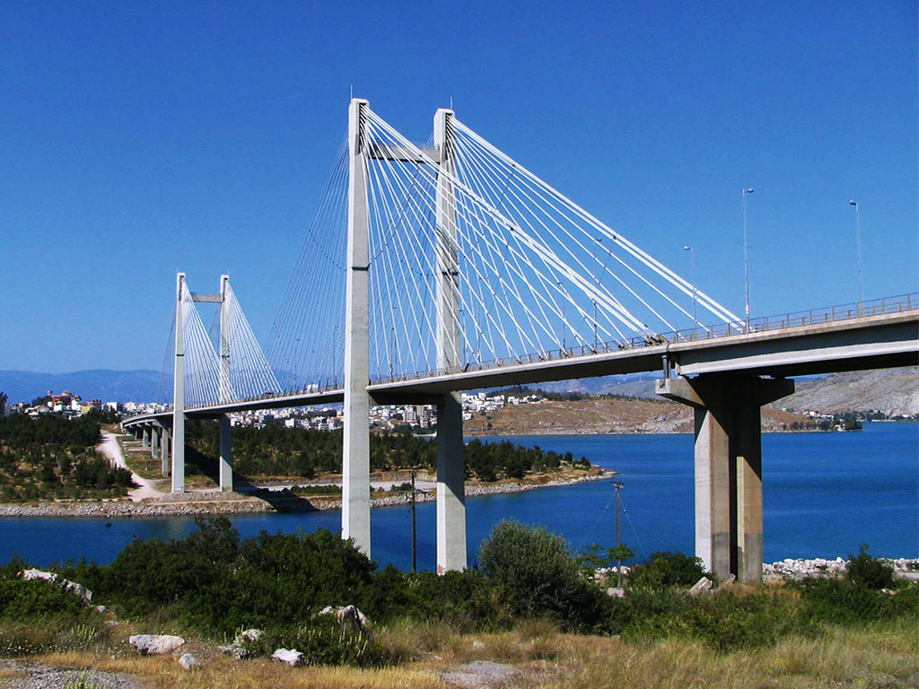
The spectacular Polyphytos Bridge, also called the High Bridge of Servia is one of the largest bridges in Greece with a length of 1,372 meters and a height of 55 meters from the water. It is part of the GR-3/E65 (Athens - Lamia - Larissa - Kozani - Florina) National Road and is located 15 km southeast of Kozani and 7 km northwest of Servia. It is one of the two bridges of the artificial lake of Polyfytos on the Aliakmonas River.  The other one is the Rimnio Bridge, which is located southwest near Aiani and is shorter, reaching 615 meters in length. Many residents of the surrounding area worked on the construction with significant gains for the local economy. At the northern end of the lake lies the settlement of Neraida, with stunning views of the bridge and lake.
 
It was designed by Riccardo Morandi and was constructed from a joint venture Xekte SA–Skapaneus SA. The construction began in 1972 along with the artificial lake and was completed in 1975. The inauguration of the bridge took place on November 6, 1976. The bridge is curved and consists of 27 giant columns that were built before the lake was formed. The columns are filled with water for more stability. The materials used for the construction were strong concrete, iron and steel. The road was constructed with the help of a crane bridge and after the lake had been fully formed.
 
In early 2020, and after a visual inspection conducted by professor Stergios Mitoulis of the University of Surrey, it was found that ageing, environmental stressors and increase in the traffic loads on the bridge lead to safety issues. These concerns resulted to traffic restrictions on the bridge aiming at reducing the load on the bridge and included banning vehicles weighing over 50 tons and reducing the vehicle speed limit to 40 kilometers per hour.

Additional Information

↔️ Width
13.50 m
🏗️ Constructor
Joint Venture Xekte SA–Skapaneus SA

Servia High Bridge Map

GPS Coordinates: 40.23444, 21.97142

More Bridges to Discover